Return to
JohnSeed.net
Los Cedros
Summary Sept. 24, 2017
The
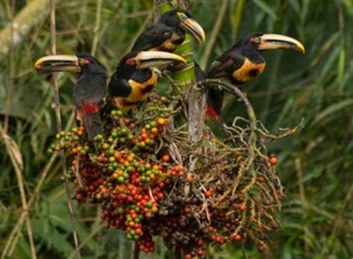
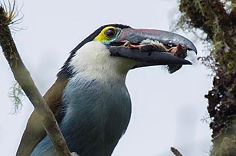
rainforests of Western Ecuador comprise what is the most ecologically diverse
ecosystem on earth. Despite Ecuador’s small size, only about 283,560 km², the
country has 20,000 species of plants. Which is 10% of the total plants found on
earth, the greatest number per unit area of any country. 18% of the worlds bird
species of which many are endemic, >1000 species of reptiles and amphibians and
a largely unknown number of arthropods with at least >4500 species of
butterflies. Not to mention the staggering array of fungi species and other
organisms. Many new species are still being discovered in Ecuador’s forests
yearly.
 Despite
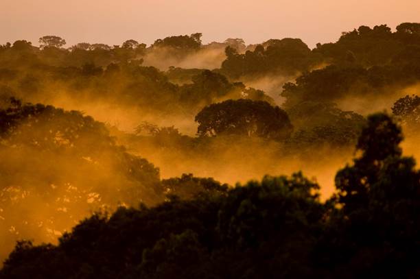
the amazing diversity, Ecuador has in the last half century experienced the
fastest rates of deforestation on Earth. Less than 2% of the original forest in
Western Ecuador remains. What is left of primary forest survives in small
reserves which still contain many of the original species of each area.
Despite
the amazing diversity, Ecuador has in the last half century experienced the
fastest rates of deforestation on Earth. Less than 2% of the original forest in
Western Ecuador remains. What is left of primary forest survives in small
reserves which still contain many of the original species of each area.
The Rainforest
Information Centre, with funding from the Australian Government’s development
assistance bureau, helped establish the
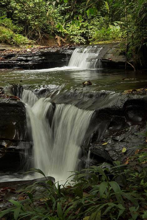
Los Cedros Biological Reserve
in Ecuador in 1988. We have continued to support reserve director Jose Decoux
throughout the intervening 30 years, and as a result, Los Cedros is the
best-forested watershed in Western Ecuador.
 Last
year, the Ecuadorean government secretly signed a mining agreement covering Los
Cedros and other “protected” areas with the Canadian mining company “Cornerstone
Capital Resources inc”.
Last
year, the Ecuadorean government secretly signed a mining agreement covering Los
Cedros and other “protected” areas with the Canadian mining company “Cornerstone
Capital Resources inc”.
This
agreement is under the “Office of Strategic Sectors” and this means no appeal
is possible nor effective oversight. This office is under tight
observation for the discovery of large scale theft and bribes being paid with
key management people either in jail or fled the country. The people who
denounced this corruption are also in jail or living underground.
Here is an article
(Aug 22 2017) about one of the corruption scandals in Ecuador involving the
vice-president. What is significant is that Glas is the head of 'Strategic
Sectors' that promotes and negotiates mining concessions.
Many of the
scientists who have worked at Los Cedros have signed a
letter attesting to the irreplaceable scientific value
of this, the last well-forested watershed in Western Ecuador.
In June 17 we added
an update
to David Nicastro’s Los Cedros video.
As of 18.9.17 our
petition had
1841 signatures and a
passionate video from Geoff Lawton,
one of the leading lights in the global permaculture movement, has had nearly
10,000 views.
As the
campaign for Los Cedros continued, it gradually became clear that our reserve
was just the tip of a huge iceberg. Many other Bosques Protectores (protected
forests) as well as indigenous reserves had also been secretly handed to the
mining companies. We employed two researchers and (so far) we have uncovered 39
 Bosques
Protectores where mining concessions have been granted.
Bosques
Protectores where mining concessions have been granted.
Ecuador has a network of 186 of these forest reserves, a total of 2.3 million
hectares (23,000 square kilometers).
As of September
15 we have identified :
- -30% of Ecuador’s
Bosques Protectores land area is now under concession.
-27 BPs will lose
over half of their area to concessions.
-15 BPs will over
90% of their area to concessions.
-Approximately
1,000,000 ha of the best bird habitat in Ecuador is now under mineral
concessions.
-Ecuador has a total
area of ~28,352,000 ha meaning that these concessions
 cover
12-13% of the total country. The Ecuadorian Andes are officially for sale.
cover
12-13% of the total country. The Ecuadorian Andes are officially for sale.
Currently we're
working on native forest and indigenous impacts maps. The impacts on Indigenous
territories is a complicated affair, as the boundaries and ownerships of
Indigenous lands are poorly documented. The map of Ecuador below shows the new
concessions in brown. The light blue is the the territory of the Shuar
indigenous nation, observe that massive amount of area that is under concession.
This is clearly related to the recent militarization of that region.

For
example, nearly all of the 311 500 hectare Bosque Protector called
Kutuku-Shaimi, where 5000 Shuar families live, has also been concessioned.
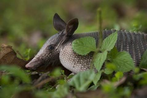
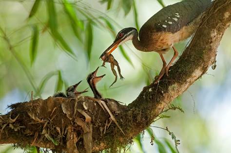
While some of these areas are in the Amazon headwaters, many lie within the
'Tropical Andes', which ranks first among the global 'biodiversity hotspots',
especially for vascular plants, birds, amphibians, and terrestrial
invertebrates. These bosques protectores are home to literally dozens of
vulnerable and endangered species and new species are being discovered by
scientists each year.

For
example: just in the Intag region, five Bosques Protectores are currently
affected by mining concessions; Los Cedros, Cebú, Chontal, El
Placer-La Florida and Siempre Verde (totalling over 18,000 has.) These
five protected areas are within the world's most biodiverse and endemic area for
birds and amphibians, and is a critical buffer to the 243,000 hectare
Cotacachi-Cayapas Ecological Reserve; this year alone, two new species of
orchids were discovered at the Cerro Golondrinas reserve (13,550 has.);
the Guayllabamba and Maquipucuna reserves (15,000 has.) provide
key habitat at the heart of the Andean Spectacled Bear Corridor declared by the
Municipality of Quito in 2013; the Cordillera Kutuku y Shaimi (342,000
has.), Cuenca Alta del Rio Nanagariza (77,330 has.), and Cordillera
del Cóndor (17,600 has.) are in ancestral territory inhabited by thousands
of Shuar indigenous families and this region is considered to have the highest
floristic endemism in the neotropics; the Cuenca del Río Paute (48,183
has.) is home to newly discovered amphibian species, is the water source for
Cuenca (Ecuador's third largest city) and the Paute Hydroelectric Dam, the
largest producer of electricity in the country.
The
protection of the 'mega-biodiversity' and critical ecosystem services these
areas provide are the reasons they were designated as protected areas.
Stripping them of this status to allow 'mega-mining' is the worst sort of
betrayal.
Return to
JohnSeed.net